
Boating At Narooma, NSW
The southern NSW Eurobodalla Coast and hinterland provide some of the most priceless experiences in all of Australia’s riches. Here, the majestic mountains of the Great Dividing Range tumble through steep forested ridges to the rich coastal plateau and its sweetwater estuarine beauty that borders the sapphire waters of the Tasman Sea.
The iconic Montague Island lies just offshore, the last step eastward across the trench to New Zealand. The coastline provides some of the closest access to the vast abyss of the Continental Shelf, made bountiful by the nutrients of the East Australian Current and rich, and fertile swell from the Antarctic.
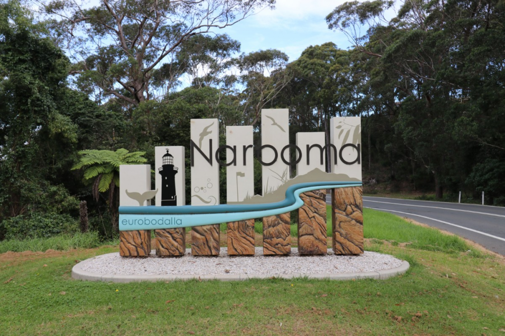
The name “Narooma” derives from the indigenous “clear, blue water,” aptly describing one of the region’s major delights. The pretty little township is home to over 3000 permanent residents and has a thriving rural and tourist centre that attracts visitors in droves throughout all holiday seasons.
It has a comfortable temperate climate that doesn’t seem to reach uncomfortable peaks in summer, and winters filled with crisp, clear mornings turning to sun-filled days that warm the heart and soul. Don’t get me wrong, Narooma can turn on some shockers too, especially in the depths of winter when the westerlies blow off the snow-covered highlands to the west. Summertime north easterlies can frustrate the most courageous seafarer, and the horrendous south easterly swells often confront opposing winds and currents to turn offshore boating conditions into a dangerous foaming washing machine.
Thankfully, the temperate climate generally means relaxed living in this aquatic playground.
Narooma is very accessible to major populations, being only a little over 200 km from Canberra and around 350 km from Sydney. Although it is a longer 683km and a good nine-hour drive from Melbourne, it is still a favourite destination for holidaymakers. The region also attracts a large transient population of inland Australian tourists from Riverina regions like Albury/Wodonga, Wagga Wagga, and West Wyalong.
The Eurobodalla region starts to the north at the major coastal township of Batemans Bay. It meanders its way through eclectic Mogo, riverside Moruya, Narooma, and the cottage handicraft and agricultural villages of Bodalla and Tilba. Narooma provides a terrific base for thoroughly exploring all the region's offerings, whether sporting, culinary, antique and bric-a-brac shopping, or simply sightseeing in a treasure trove of coastal eye candy.
Back to Nature
The rich diversity holds a myriad of wildlife, both terrestrial and aquatic. For hunters, there are deer, foxes and assorted vermin, while the steep forests are alive with Australian native animals and mammals delighting bushwalkers. The air is filled with a vast diversity of birdlife from forest foragers, coastal waders, seabirds, and birds of prey such as the magnificent wedge-tailed and sea eagles, ospreys, owls, plus it is a summer residence or stopover to many international migratory species and home to endangered hooded plovers.
The sweetwater estuarine waters of the Eurobodalla are often referred to as the Oyster Coast, claiming the cleanest and least polluted waterways of any on the eastern seaboard. It has ideal water temperatures for a variety of aquaculture species, including precious Sydney Rock and Pacific Oysters, and its produce is celebrated in style each May with the annual Narooma Oyster Festival.
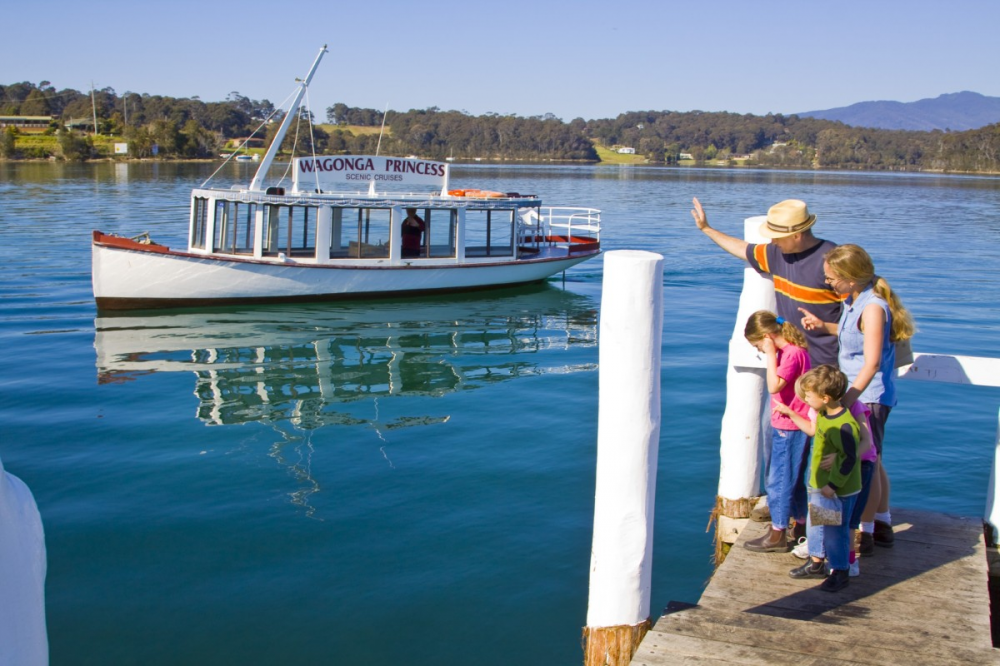
Take a tour, or preferably your own boat, to discover the secrets in most of the coastal inlets, including the Clyde River at Batemans Bay, Tuross Lake and the Wagonga Inlet, which provides the setting for the Narooma township.
The region abounds with State forests and National Parks, whose natural bushlands invite a wide range of recreational opportunities, including mountain biking, four-wheel driving, horse riding, and bushwalking through often steep and challenging trails with spectacular views. There are plenty of more moderate bushland adventures teaming with flora and fauna for the less adventurous or physically capable.
Narooma, Tilba and nearby Bermagui to the south lie in the shadow of the mighty Mount Dromedary, or "Gulaga" in the indigenous language of the local Yuin people. This beautiful mountain is precious to Aboriginal spiritual identity, with a steep rainforest walk to the peak, leaving from the rear of La Galette (formerly “Pams Store”) at Tilba Tilba, made prominent by gold miners back in the rush of 1884. “The Drom” is an important landmark to seafarers, particularly in the dark ages before GPS.
The entire region was hit very hard by the 2019 bushfires, with large areas now showing regrowth, not only with the vegetation but with many shops, facilities and services, including tourist attractions such as the Mogo Wildlife Park and Eurobodalla Regional Botanic Garden.
Beauty in Every Direction
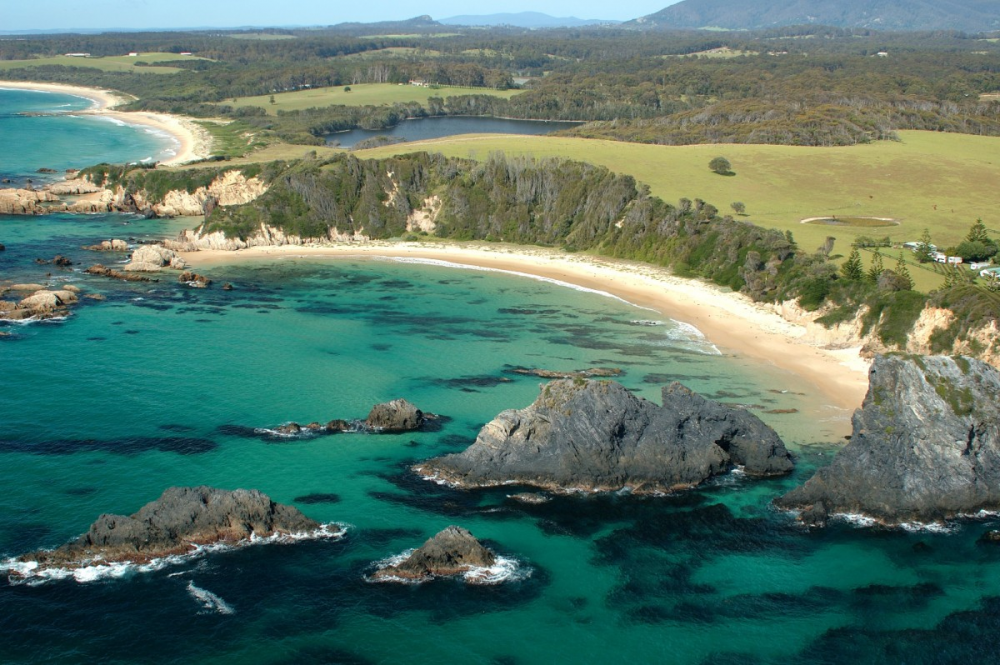
It doesn’t matter what direction you come from, Narooma greets you with inspiring landscapes. The road winds through steep hills to the north, opening to a magnificent vista of the estuary side hamlet and ocean entrance at the infamous seaway leading out to the iconic Montague Island, only 9 km to the southeast. You can take the coastal detour through populated Dalmeny and Lake Mummaga, where you will find a spectacular array of headlands and beaches with exciting surf breaks. There is a ripper coastal walk from Dalmeny to the Mill Bay Boardwalk and the historic Wagonga Inlet Bridge that welcomes you to the town centre in North Narooma.
From the south, you can take the coastal drive up the coast from Tathra to Bermagui, over the bridge at Wallaga Lake and back out to the highway just short of the Tilba turnoff. Alternatively, stick to the highway from beautiful Bega and through the rolling hills and countryside of the lush pastoral land and mountainous forests through Cobargo. Don’t forget to stop and leave a little money in one of the handicraft, art or local produce stores, as this little town was one of the hardest hit by fires.
The road north from Tilba to Narooma takes you past the enchanting Mystery Bay turnoff. This little coastal wonderland has a small permanent community in a superb coastal setting with surf and swimming beaches and rocky headlands with crystal clear rockpools. The local tourism website describes Mystery Bay as, “Surrounded by national park, this sleepy backwater comprises a few modest houses, a primitive camping ground, a phone box and an embarrassment of spectacular beaches.” There’s even a small ocean boat ramp that once hosted many sportsfishing championships for little boats heading seaward in search of the region's large pelagic and resident denizens of the deep offshore waters.
The coastal plain starts to flatten northward of Corunna, with large lakeside vistas on both sides of the road, including Nandudga and Bullengella Lakes, before you get the first glimpses of Forsters Bay on Wagonga Inlet at Narooma.
You wind down through the hills past the picturesque primary school with a turn to the right leading to the industrial area and historic cemetery on the headland overlooking Glasshouse Rocks and Montague Island. Take the time to stroll through the cemetery to remind yourself of past struggles, or perhaps take time out with the young’uns to learn a little history of the folk that made our great land. There are seafarers, woodcutters, gold diggers, farmers, fishers, and supporting networks from colonial times until now.
You wind down the hillside to the lakeside CBD with its magnificent golf course hugging the coast to the inlet mouth and seaway. There’s a full range of services including pubs, restaurants, supermarkets, a wide assortment of accommodation options, shops, watersports services, a boat shop and a range of cafés and seafood outlets.
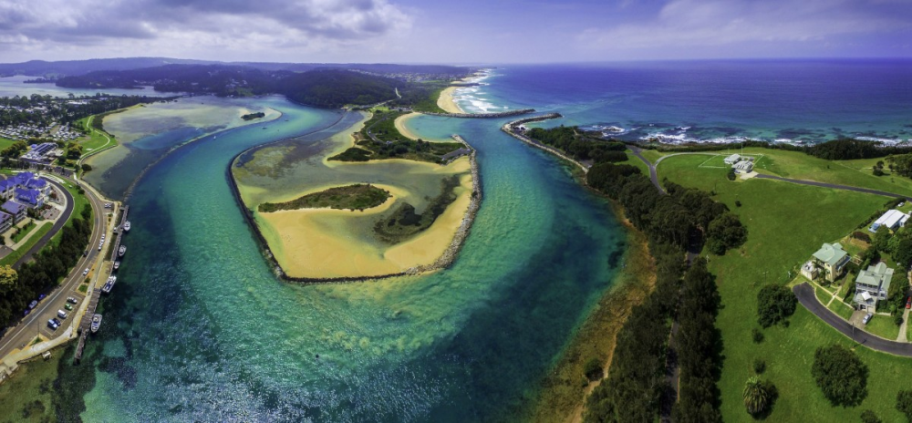
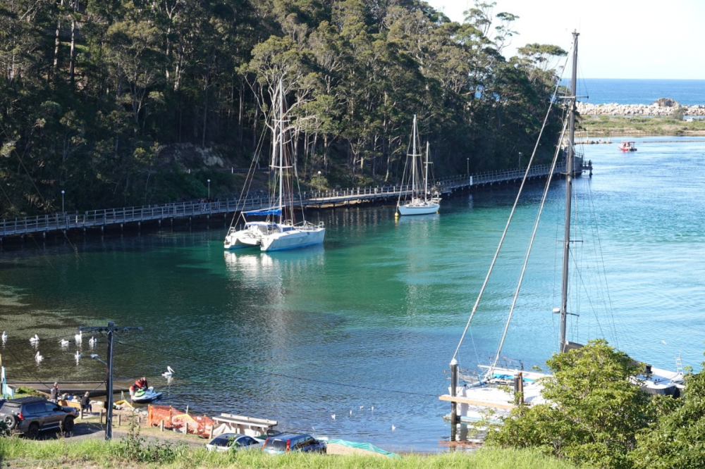
Explore Narooma Marina on Wagonga Inlet
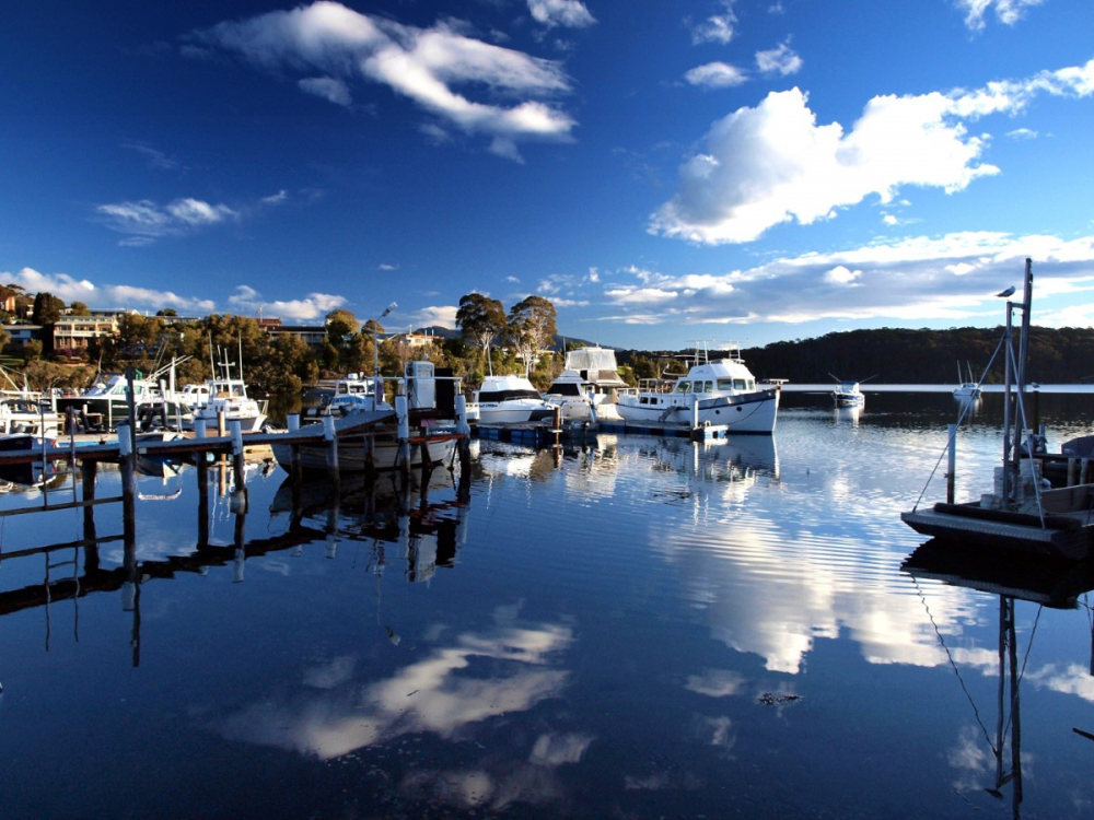
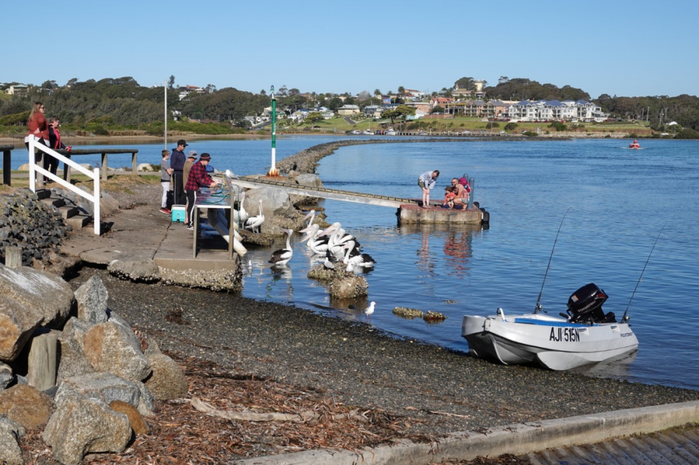
Spend some time cruising the lakeside, both east and west. To the west, the township fronts the inlet with its small marina, boatsheds, seafood outlets, fisherman’s shacks, beautiful parklands, cafés, and restaurants, including oyster sheds. The shoreline winds around Forsters Bay, with some lovely vistas looking back over the lake. Tree-lined edges lead to a quite serviceable little boat ramp with fish cleaning facilities.
Wagonga Inlet winds its way down to the entrance on the eastern side of the township through a well-defined series of channels, sandbars and even a small and secure sandy swimming beach on the north side. There’s a very popular waterfront caravan park right in the middle of town, before the waterway streams past the professional wharf, twisting through fast-flowing, rock-lined channels before making its way to the entrance. The wharf provides the main moorings for an extensive charter fleet servicing offshore sport and game fishing, diving and whale watching.
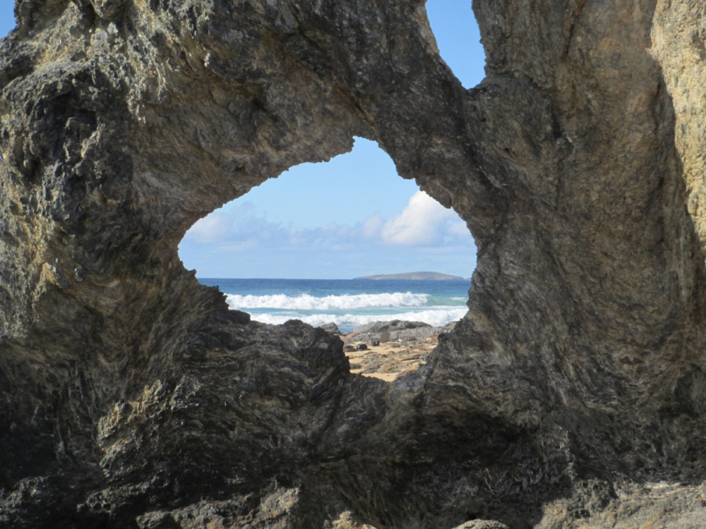
Looking oceanwards from the last bend before committing to the ocean entry is a rock formation called Australia Rock. Its unique natural structure has a hole in its centre that closely resembles a map of the Australian mainland, making it a popular tourist attraction. There are a number of explanations for its unusual structure, firstly being just a coincidental natural phenomenon, secondly that it was worn to shape by the chain moorings of a ship at the heads and another suggestion that seafarers actually blasted it as an inspection point for the rolling swell before committing to traverse the hazardous bar.
The Entrance
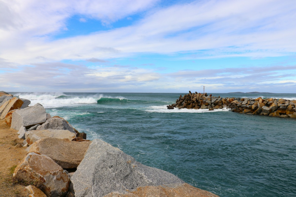
The seaward entrance to Wagonga Inlet is set between two large breakwaters, with the southern extending from Wagonga Head for about 240m and the northern extending about 300m from the beachfront reserve. The breakwalls were constructed between 1976 and 1978 to reduce the hazard that took its toll on many trade and recreational vessels.
Whilst the channels are now more predictable, they are still regarded as one of NSW's most dangerous bar entries, particularly with any swell and an outgoing tide. There are moving sandbars that often surprise boaters with pressure waves that seem to stand up from out of nowhere. However, the big easterly swells can make the bar so treacherous with swell heights and breaking waves that can increase quickly, particularly on the ebb tides. Get plenty of local advice and watch the conditions from the overview Bar Rock Lookout or the seawalls themselves.
That said, the inlet is a very popular ocean access for a great deal of oceanic boating, fishing and diving, plus there are no height restrictions up to the wharf area for visiting yachts and larger craft. In reality, there are many times when you could virtually water ski through the bar, but understanding local conditions and weather forecasting is vital. We advise you to log in and out with Marine Rescue Narooma on Channel 16 on VHF (distress and calling channel) or Channel 88 (27.880 MHz) on a 27 MHz radio, and perhaps call in for a chat at the headquarters at the Old Pilot House on the Wagonga headland.
Inshore Narooma NSW
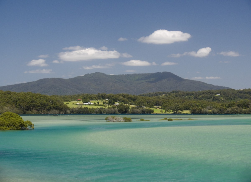
The estuary is classified as a drowned river valley that extends about 9km upstream of the permanently open entrance. Its catchment area isn’t overly large, keeping salinity levels not far from oceanic levels. This creates a very individual marine environment with extensive nursery areas and seagrass beds sustaining aquatic life.
Target estuary species bream, flathead, mulloway, tailor, Australian salmon, sand whiting, garfish, mullet, trevally, luderick and leatherjacket with bass yabbies (nippers), sandworm and beach worm available for live bait collection. You can fish the sand flats, deep running channels, weed beds or quiet backwaters, but be careful to identify the extensive Marine Park areas that are strongly enforced. The waterway is also popular for safe swimming, kayaking, general boating and watersports. There’s also plenty of land-based options and non-water-based activities, such as sightseeing around the riverside parks and boardwalks. The Mill Bay Boardwalk meanders along the stunning water’s edge to Apex Park, where the clear waters at Bar Beach invite you to dive in for a sheltered swim or snorkel in the aqua water and golden sands.
The breakwalls are very popular fishing platforms, particularly for Australian salmon, tailor, bream, mulloway and various shark species that regularly maraud the baitfish schools in the heavily oxygenated water. The beaches and inshore reefs hold a similar range of fish with greater populations of snapper, morwong, yellowtail kingfish, bonito, gummy and school sharks, plus the occasional mako or whaler shark.
Offshore Narooma
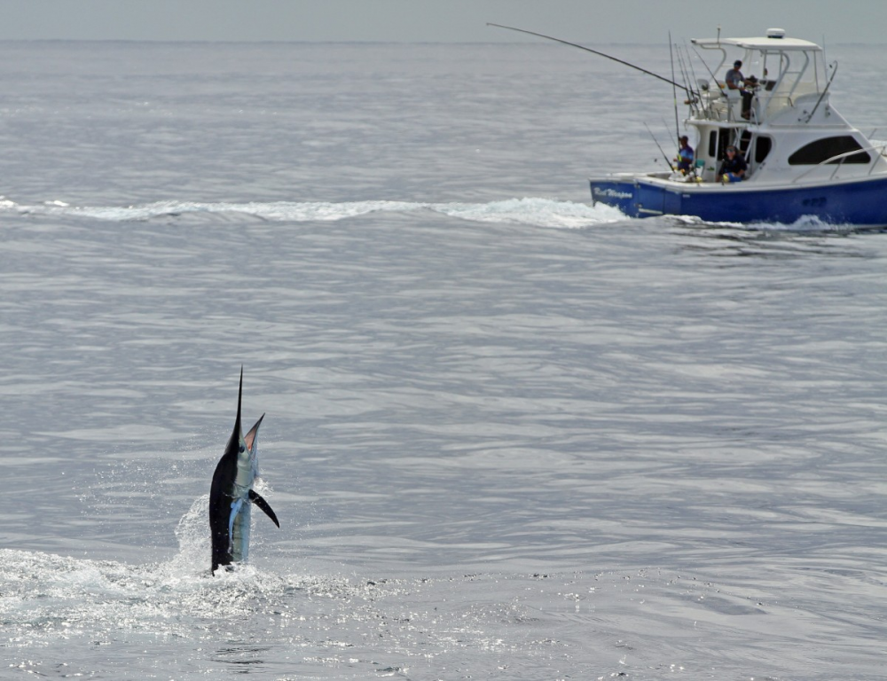
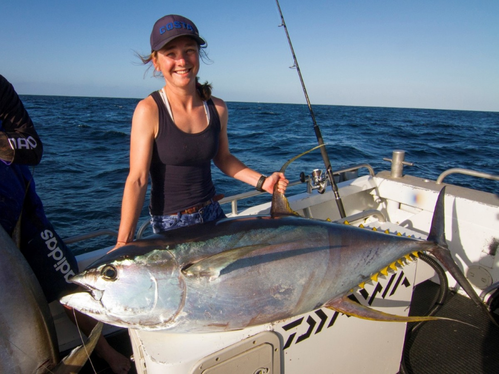
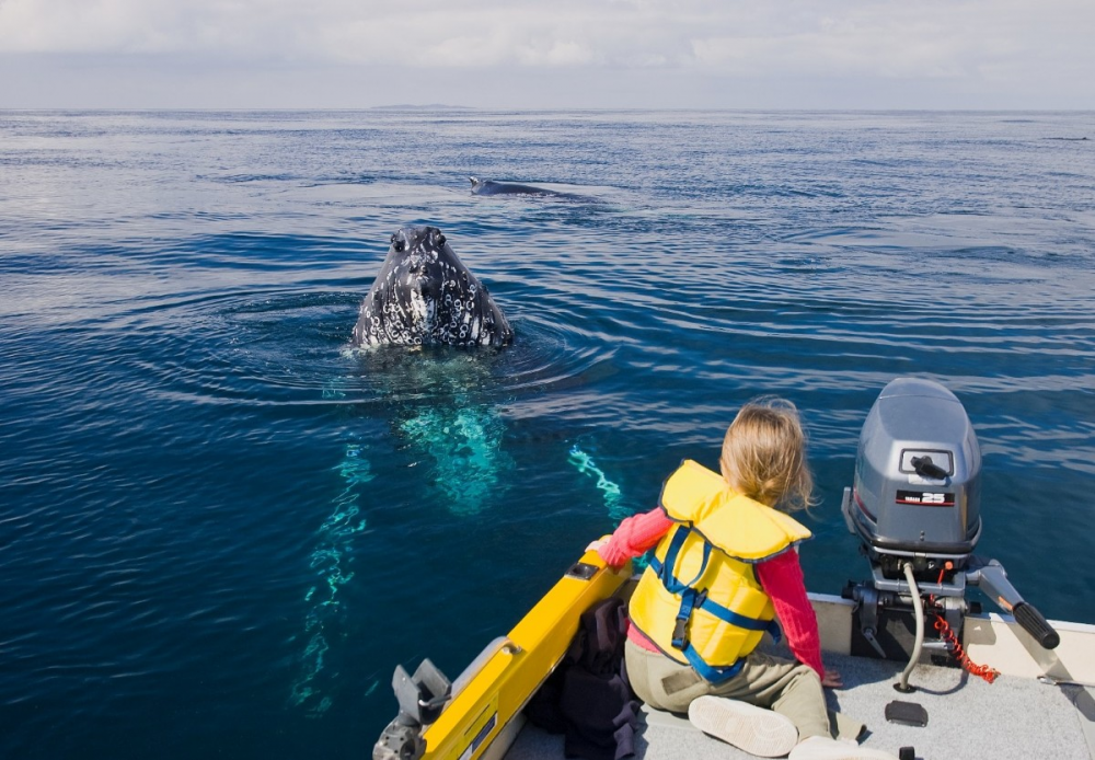
Only 30 km down the coast, Bermagui was once rated as the game fishing capital of Australia, and Narooma fishos share similar waters. While there’s plenty of fishing to be had inshore of the Continental Shelf, the potential for the large pelagics increases with the water depth. Black, blue and striped marlin, short-billed spearfish, yellowfin tuna, mahi mahi, and albacore are serious target species from roughly November to June. In the winter months, the majestic southern bluefin tuna generally arrives well off “the shelf” with mako, whalers, and tiger sharks almost all year round. Don’t be surprised by the arrival of a great white, and usually at the worst possible time.
Having influence from the East Australian Current means whales are commonplace from right in close to the coast to out over the shelf throughout their migratory seasons. The expected species include Humpbacks, Southern Right whales, Fin whales, Brydes whales, Sei whales, Blue whales and Orcas, with some coming up close to boats, creating terrific experiences for man and beast. Narooma is said to have a sighting success rate of 98% during peak season from September to November as they head southward towards Antarctic waters. They head north again chasing the krill throughout the winter months.
Montague Island
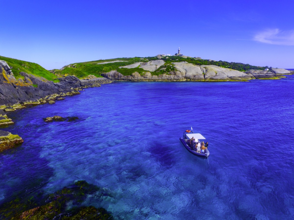
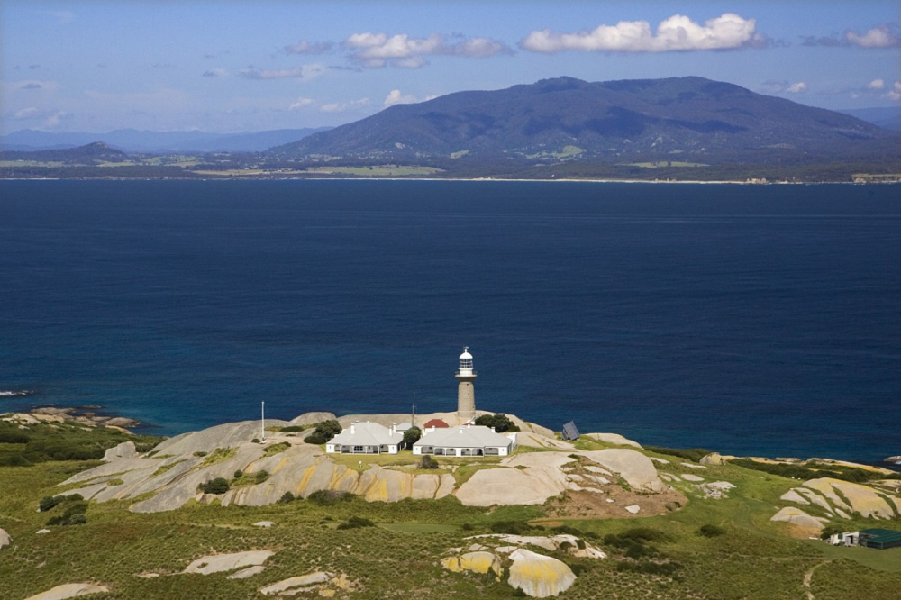
Montague Island is a unique wildlife sanctuary that is only a hop, skip, and jump southeast of Narooma. The fishing, diving, and boating offerings are truly world-class. The Island has a very interesting rock structure, mainly basalt to the north and granite to the south.
The Montague Island lighthouse was first lit in 1881 and converted to a fully automated system in 1986. It serves as a welcome guide to coastal voyagers and stands as a monument to the iconic structure of this beautiful island. It remains a part of Australia’s coastal navigation system and nautical history.
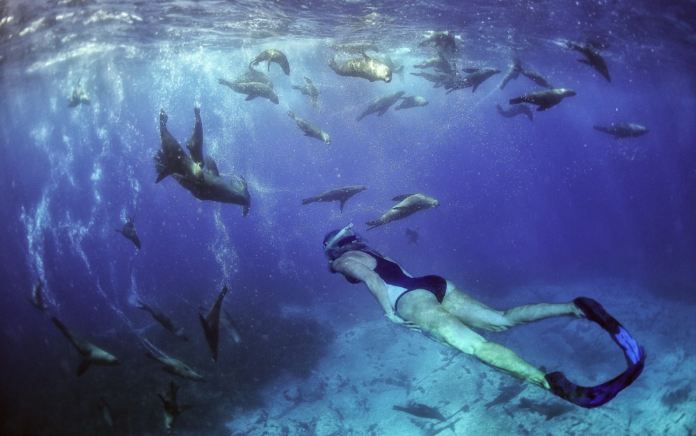
The island is now administered by the National Parks & Wildlife Service, which protects the huge colonies of seals and little penguins, as well as over 90 species of birds that visit or make the sanctuary their home. Limited accommodation is available in the old Lighthouse Keeper’s Cottages for a unique experience.
Montague Island is truly a Mecca for whale watching, seal viewing, penguin tours, scuba diving, snorkelling, seal dives, grey nurse shark dives, wildlife cruises, and bird-watching trips. Many charters and tours are available daily from nearby Narooma. The island is a fisherman’s paradise with a host of temperate oceanic species on offer, but the most favoured are perhaps the hard-fighting yellowtail kingfish, snapper, and a plethora of pelagics.
Wrap It Up
Narooma is an ideal destination for your next holiday, especially if a boat or watercraft is involved. The township supplies everything you need, whether on a fishing trip with your mate or a family holiday. The township's size isn’t too big, and not too small either, with plenty to keep everyone well occupied both on and off the water.
The fishing and boating opportunities are sensational, but so are the culinary delights, the history, the walks and bike rides, the surf, the beaches, the magnificent coastline, and the hospitality. You will love the surrounding district with its quaint hamlets, vineyards, cheese factory and eclectic shopping opportunities amongst some of the Great Divide’s most beautiful mountain ranges and forests.
Visitor Information
Boat Ramps
-
Mill Bay – Centenary Drive, Narooma
A one-lane concrete ramp. Access to the Wagonga Inlet. Car Trailer Spaces – 10 -
Apex Park Boat Ramp – Centenary Drive, Narooma
A two-lane concrete ramp. Access to the Wagonga Inlet. Car Trailer Spaces – 51+ -
Forsters Bay Boat Ramp – Lake View Drive, Narooma
A one-lane concrete ramp. Access to the Wagonga Inlet. Car Trailer Spaces – 10
Walks and Rides
Narooma districts have 400 km of easy pathways and trails along the coast and through villages and towns. There are viewing platforms where you can picnic, spot whales and other wildlife, or simply enjoy the view.
Some walks include
-
Bingie dreaming track south of Moruya.
-
Mangrove walk, Cullendulla Creek Nature Reserve
-
Myrtle and Dark Beach, an ancient headlands walk, Murramarang National Park
-
Banksia walk, Burrewarra Point
-
Broulee Island Nature Reserve
-
Lake Brou to Potato Point
-
Bendethera Caves Walking Trek
Oyster experiences include
-
Narooma Oyster Tours
-
Narooma Oyster Festival (May)
-
Region X Oyster Tour
-
Wagonga Inlet Cruises (Narooma)
-
The Oyster Farmer's Daughter (Oyster Bar & Restaurant)
Living History and Tours
-
Wagonga Inlet Cruises (Narooma)
-
The heritage villages of Central Tilba and Tilba Tilba
-
Tilba Easter Festival
-
South Coast Cheese at the old ABC Cheese Factory.
-
Narooma Lighthouse Museum at the Narooma Visitor Centre
-
Sapphire Coastal Adventures (Whale watching South Coast)
-
Narooma Charters
-
Charter Fish Narooma
Marine Parks
The NSW government established Batemans Marine Park in 2006. It covers 85,000 hectares and extends from Murramarang Beach near Batemans Bay in the north to Wallaga Lake. It stretches three miles offshore and includes all the estuaries, creeks, rivers, and lakes (except Nargal Lake) within the Eurobodalla region.
The Batemans Marine Park puts minimal restrictions on recreational fishing. Trawling, long lining and dredging are prohibited from the entire park, and some other forms of the commercial fishery are also limited to protect the region’s biodiversity.
Sports Clubs
-
Narooma Sports & Services Club
-
Narooma Dragon Boat Club.
-
AFL – Narooma Lions FC.
-
Narooma Sport and Gamefishing Club
-
Narooma tennis complex (5 synthetic grass courts and club
-
Narooma Golf Course (ranked 68 out of Australia’s Top 100 Golf Courses).
Ready to Set Sail?
Find your dream boat online at Only Boats! We have great deals on all boats for sale, including used boats and new boats. You can also check out our used boat buying guide.
Do you want some help planning your next boating holiday? We can help with some ripper destinations such as our guide to boating at Nelson, Vic or perhaps our guide to boating at Tin Can Bay, Qld.
Smooth sailing starts with the right boat. We’re here to help you find it!
Getting boat finance sorted shouldn't be the hard part of boat ownership. Credit One has helped thousands of Australians get on the water, earning a reputation as Australia's best-reviewed finance broker with 3,000+ glowing Google reviews to show for it. See what customers have experienced by reading their Credit One reviews, or use the loan repayment calculator to work through your options.